For the nearly twenty years we’ve covered Chile’s most relevant national commemoration, the Great Military Parade (Gran Parada Militar), we’ve tried to find new and different locations to illustrate its flying component away from traditional viewpoints, and this year we propose an exciting “near air-to-air perspective”.

Our initial report back in 2007 visited several photographer preferred locations around Commodore Arturo Merino Benítez international airport (Aeropuerto Internacional Comodoro Arturo Merino Benítez), while in 2008 we first tested Kings Park (Parque de los Reyes) to catch parading aircraft approaching at low altitude about 2 NM north of O’Higgins Park (Parque O’Higgins) parade ground.

Our curiosity to identify “near air-to-air” locations first bit while Chile’s social outbreak in October 2019 and the COVID pandemic reduced the ceremony’s splendor and made it a bit unsafe or unhealthy to go out with expensive photo equipment, thus limiting our options to reduced human traffic areas such Potato Hill (Morro La Papa), where we managed to picture the Halcones aerobatic team approaching Las Condes’ Military Academy (Escuela Militar) for the 2020 event.

In 2022, we managed to register a few “air-to-air like” images from Saint Cristopher Hill (Cerro San Cristóbal), but results were not the best due to limited lighting (partly cloudy skies) and photo equipment limitations to picture aircraft flying 1.7 NM away from our location.

Does a Mach Loop exist in Chile?
Once the nation restored some of its democratic stability after two failed attempts at constitutional reformulation, 2024 research revealed the bulk of (but not all) formations usually flew over the Mount The Region (Cerro La Región) range before entering Greater Santiago’s from the north on approach to O’Higgins Park.

Inadequate planning led us to set our sights on Sugarloaf Hill (Cerro Pan de Azúcar), a 3,038 ft. distinctive landmark at Chicureo’s southern entrance (a suburb 12 NM north of O’Higgings Park) and climbed it on September 19 without any preliminary exploration… only to find out it was fairly inadequate for our purposes: Hampering our camera sensor’s ability to pick fast moving planes, the bulk of the formations flew 1.5 or more nautical miles east of our position, with sunlight on their tails and dark clouds plus obscured Andes mountains on the background.

But the expedition was not a complete failure: We managed to get at least a few good shots of aircraft flying right over Pan de Azúcar while on a lengthy initial approach to Pudahuel for landing south to north on runway 35 due to the unusual weather… and we got a glimpse of what photography at a Chilean Mach Loop would look like if we found a location better oriented and closer to the flight path into the O’Higgins Park!

Improved research, project discussions with MyyHobbys CEO, José Ignacio Bertea (himself a Chicureo resident for over 20 years), and reserving time for an exploratory excursion brought about a better prospect located on Thorn Tree Hill (Cerro El Huitre), a 2,982 ft. elevation 2 NM east of Pan de Azúcar in the same range as Cerro La Región.

After climbing it for the Tuesday 15 Preparatory Review (Revista Preparatoria) rehearsal, a precise path was followed to reach El Huitre’s summit within one and a half hour from our start in south central Chamisero (one of several suburban developments in Chicureo) as Gran Parada aircraft started taking off from Pudahuel and El Bosque air bases at midday on Friday 19.

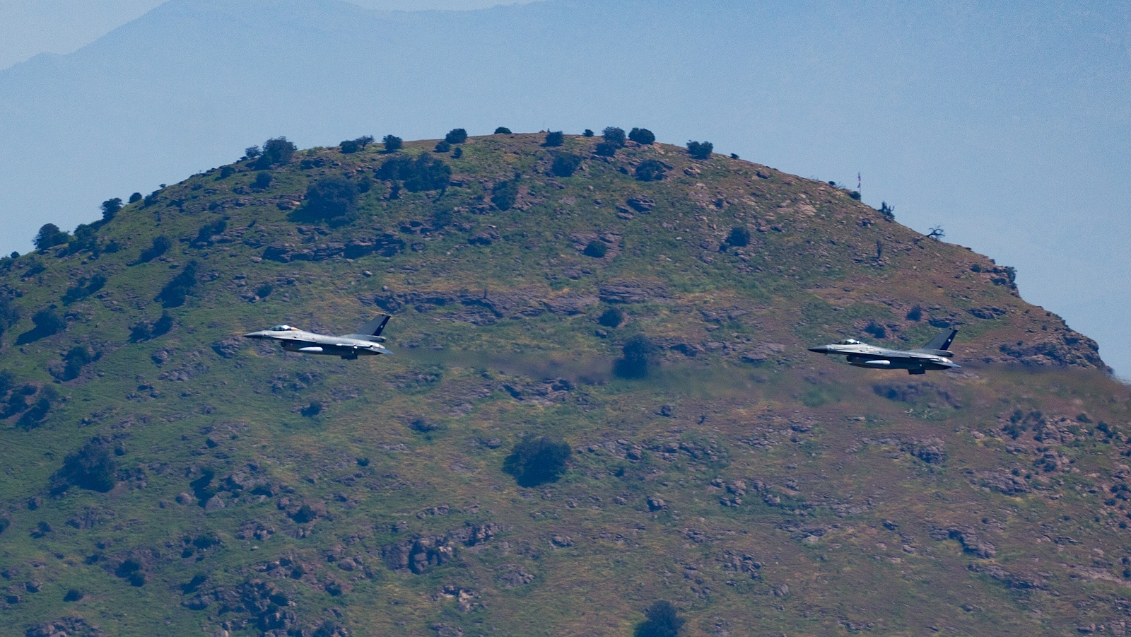
By the time we reached the summit, aircraft were flying their holding patterns in three different areas: Elements #1 (five Gamebird GB-1s and seven T-35 Pillanes) and #4 (one S-70 Blackhawk and two DHC-6 Twin Otters) were running race track circuits between eastern Huechuraba and northern Recoleta, while #2 (four F-5 Tigre IIIs, 13 F-16 Vipers and individual KC-135 Stratotanker, KC-130 Hercules, Boeing 737 and Gulfstream IV) did it over Colina and #3 (two S-70 Blackhawks, two Bell 412s and two UH-1H Hueys) did so between Renca and eastern Quilicura.

As stated above, not all formations provided adequate “photographic posing” close to El Huitre: Elements 1 and 3 were essentially hiddend behind Cerro La Región, element 4 did so farther than last year (when we caught them from Cerro Pan de Azúcar) and all transport jets in element 2 avoided our position by entering urban Santiago and the parade grounds from a northwestern direction.

In spite of these auspicious results, the quest isn’t complete: We look forward to new opportunities to visit Cerro El Huitre or other view points in the area (for instance, Cerro La Región, to capture aircraft in the Huechuraba holding pattern) hoping that Chilean air formations will give us new and improved poses to convert covering the Great Military Parade from the Chilean Mach Loop into a new tradition.
References: This story was partly produced with Chat GPT support to improve English editing quality and topographical translations.

